Priyanka
Belbase
PhD Researcher in Earth System Science specializing in remote sensing, GIS analysis, precision agriculture, geodatabase administration & spectral diagnostics. 7+ years transforming complex geospatial data into actionable environmental and infrastructure insights.

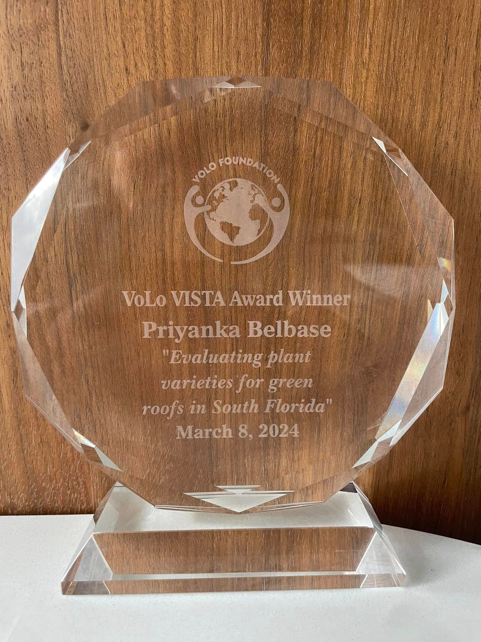
VoLo VISTA Award
VoLo Foundation • February 2024 • Associated with Florida International University
🏆 2024 VISTA Award Winners Announcement
The VISTA Award is the highest recognition from VoLo Foundation, bestowed upon students demonstrating exemplary leadership along with Vision, Innovation, Sustainability, Technology, and Action in climate solutions.
Award-Winning Team
Project Impact
- ▸Addresses urban heat island effects through green roof implementation
- ▸Contributes to carbon sequestration in urban environments
- ▸Aids in controlling stormwater runoff - a significant issue in Miami
- ▸Research on plant varieties for green roofs in South Florida climate
Research Partnership Program Winner
Feb 2025 – Present
Awarded for collaborative research partnership support tied to spectral instrumentation and applied dragon fruit research.
Bridging Geospatial Science & Precision Agriculture
I'm a PhD researcher in Earth System Science at Florida International University, specializing in dragon fruit mapping, agronomy, soil-plant nutrient dynamics, and spectral reflectance diagnostics.
My research combines advanced remote sensing techniques with field-based chemical analysis (XRF, ICP-MS) to understand plant physiology, detect disease patterns, and develop precision agriculture tools.
With 7+ years of professional GIS experience spanning environmental planning, emergency management, utilities, and agriculture across Nepal and the United States, I bring expertise in geodatabase management, spatial analysis automation, and transforming raw data into decision-driving insights.
Beyond research, I'm passionate about mentoring students, delivering GIS training workshops, and contributing to sustainable agricultural practices for smallholder farmers worldwide.
Ph.D. in Earth System Science
Florida International University, Miami, FL
M.S. in Geoscience
Florida International University, Miami, FL
M.S. in Environmental Science
Tribhuvan University, Nepal
Current Role
Graduate Research Assistant
Skills & Technical Proficiencies
GIS Platforms
Remote Sensing Data
Spatial Analysis
Field & Spectral Tools
Programming & ML
Geodatabases & Data Engineering
Web GIS & Reporting
Environmental & Domain
Planning, CAD & Visualization
Professional Experience
Graduate Research Assistant - GIS & Remote Sensing Specialist
Environment & Earth Remote Sensing Lab, Florida International UniversityMiami, FL
- Conduct large-scale remote sensing analyses using Planet, Sentinel-2, NAIP, LiDAR, and multispectral datasets for crop mapping, land-cover classification, and temporal growth assessment.
- Develop automated Python, ArcPy, R, ModelBuilder, and Google Earth Engine workflows for data ingestion, image classification, vegetation index extraction, change detection, and time-series analysis.
- Administer research geodatabases and spatial data libraries, including schema design, metadata documentation, QA/QC procedures, and integration of raster, vector, spectral, chemical, and field datasets.
- Design predictive and machine-learning workflows integrating hyperspectral reflectance with XRF and ICP-MS data to detect nutrient deficiencies, disease signals, and crop-health patterns.
- Build ArcGIS Online dashboards, web maps, and near real-time crop-health displays that translate multi-source geospatial data into decision-ready visual products.
- Interpret laboratory and field analytical results, compare findings against environmental benchmarks, and communicate results through publications, conference presentations, maps, and reports.
- Manage greenhouse operations, field sampling campaigns, environmental controls, pest monitoring, and research data processing workflows.
- Mentor undergraduate students and facilitate GIS and environmental science labs, lectures, field protocols, and spatial data management training.
Environmentalist & GIS Specialist
National Land Use Project, Bhugol Engineering Consultant Pvt. Ltd.Kathmandu, Nepal
- Led end-to-end GIS and environmental planning support for national land-use classification, zoning, hazard mapping, suitability modeling, and constraints analysis across multiple districts.
- Performed environmental impact assessments, permitting support, due diligence, and compliance reviews using geospatial modeling, hazard and vulnerability mapping, field surveys, and terrain-hydrology analysis.
- Designed and maintained enterprise geodatabases with subtypes, domains, topology rules, metadata standards, CAD/GPS/tabular conversion workflows, and multi-user editing procedures including post-and-reconcile support.
- Developed GIS applications, automated geoprocessing tools, and map-production workflows for infrastructure planning, agricultural modernization, and environmental management systems.
- Consulted with government agencies, engineering teams, contractors, and regulatory bodies on land-use policy, zoning compliance, proposed regulations, permitting, and environmental constraints.
- Delivered GIS training workshops, mentored junior staff, coordinated multidisciplinary contributors, and produced technical reports and cartographic deliverables for national review.
GIS Assistant / Analyst
Geo Spatial Engineering Solutions Pvt. Ltd.Nepal
- Processed satellite imagery, DEMs, LiDAR, vector data, CAD files, GPS records, paper maps, and survey datasets for infrastructure feasibility, routing, and environmental planning projects.
- Built repeatable ArcGIS ModelBuilder and Python workflows for data cleaning, topology validation, conversion, ETL-style preparation, and production mapping.
- Digitized parcels and zoning districts, linked attribute tables, managed metadata, and prepared searchable zoning maps and public-facing GIS outputs.
- Supported online and enterprise GIS map publication, third-party data integration, hardware/software requirements review, and spatial data library organization.
- Collaborated with engineers, ecologists, and planners to integrate spatial datasets into feasibility studies, reporting, and operational decision-making.
GIS Digitizer / Technician & Cartographer
ShreeRS ConsultantNepal
- Digitized land parcels, zoning boundaries, administrative boundaries, and infrastructure layers with strong attention to georeferencing, topology correction, and attribute quality.
- Prepared field maps, supported GPS-based data collection, and assisted with layer conversion, integration, and GIS deliverable packaging.
- Maintained spatial data libraries and created standardized cartographic layouts and map products for engineering, environmental, land-use, and utility planning projects.
Academic Contributions
Click any card to expand full details.
Objective
Develop a Nutrient Deficiency Scoring (NDS) framework integrating eleven macro- and micronutrient concentrations into a single composite index and evaluate correlation with full-range hyperspectral reflectance (350-2500 nm) across three growing seasons.
Methods
- Macronutrients standardized to ppm via x10,000 conversion for unified scale
- Weighted proximity-to-optimum NDS (range 0-100) with sign-inversion transformations
- Pearson correlation across full VIS-NIR-SWIR spectrum
- Vegetation index analysis (NDVI, GNDVI) vs. composite NDS
Key Results
- NDS achieved r = 0.794 (p < 0.001) at 816 nm within NIR plateau
- 1,905 wavelengths with r > 0.60 identified as prediction-capable bands
- N: r = -0.738 at 811 nm; P: r = -0.712 at 1,997 nm
- NDS increased across seasons (2022: 28.3 -> 2025: 83.6; F = 91.03, p < 0.001)
Conclusion
NIR and SWIR spectral regions provide complementary windows for non-destructive multi-nutrient deficiency estimation. Full-spectrum data outperforms standard VIs for monitoring.
Image
Attachments
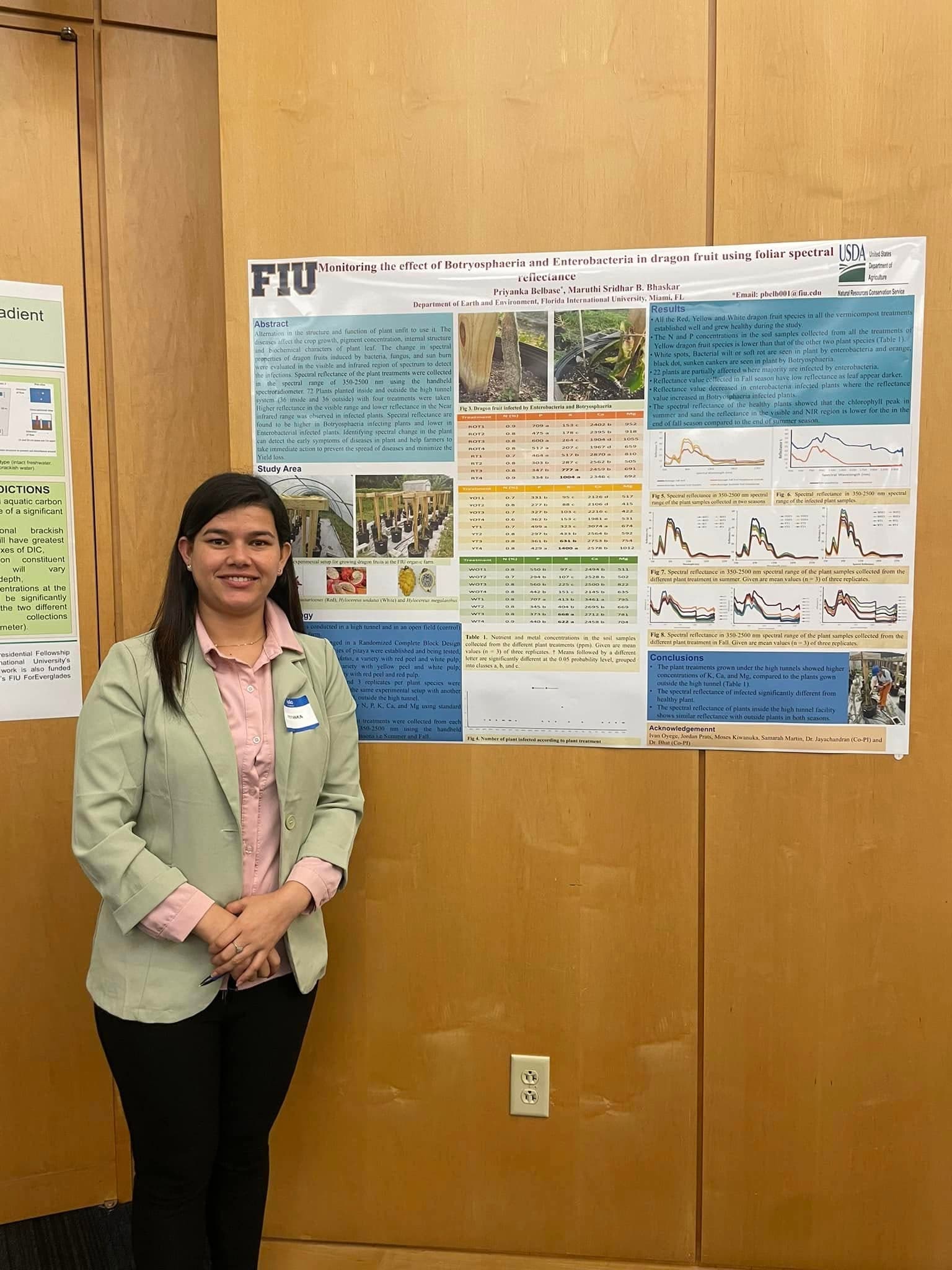
Objective
Investigate early disease detection in dragon fruit using chlorophyll peak reflectance at 120, 365, and 945 days after plantation.
Methods
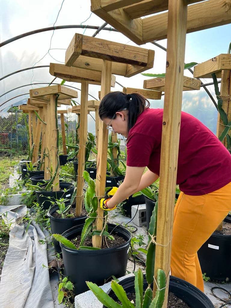
- RCBD design at FIU organic farm - high tunnel + open field
- Three species (H. undatus, H. megalanthus, H. costaricenes), 4 treatments, 3 replicates
- Spectral reflectance 350-2500 nm at cladode and canopy levels
Key Results
- Healthy plants (120 days): strong chlorophyll peaks and high NIR reflectance
- Disease progression (365-945 days): diminished chlorophyll, decreased NIR
- Diseases identified: Stem Canker, Anthracnose, Bacterial Soft Rot, Botryosphaeria, Enterobacteria
Conclusion
Spectral analysis enables early disease detection before visible symptoms appear, supporting precision agriculture interventions.
Image
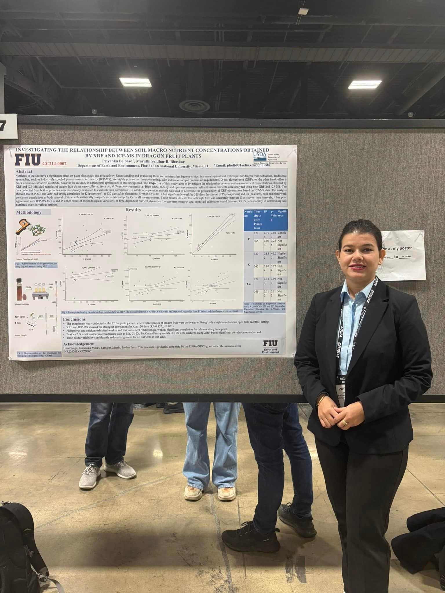
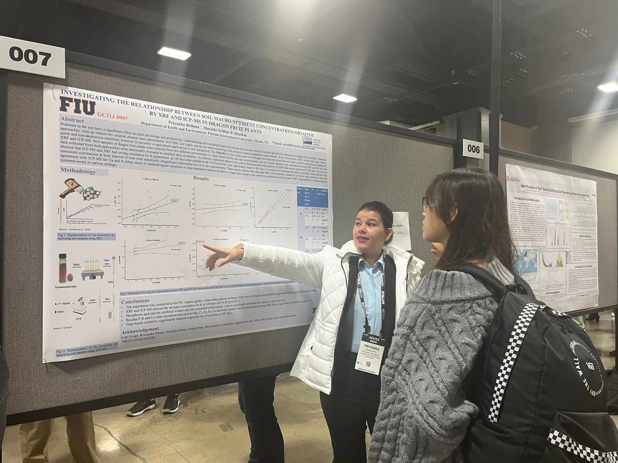
Objective
Evaluate XRF as a rapid, non-destructive alternative to ICP-MS for soil macro-nutrient analysis in dragon fruit cultivation.
Methods
- Soil samples from high tunnel and open environments at FIU organic garden
- Three dragon fruit species; XRF + ICP-MS analysis at 120 and 365 days
- Statistical correlation and regression analysis
Key Results
- K (potassium): R^2 = 0.852, p < 0.001 at 120 days
- P: moderate correlation at 120 days (R^2 = 0.198)
- Ca: no significant correlation at any time point
- All nutrients weakened significantly by 365 days
Conclusion
XRF accurately measures K at shorter intervals but shows poor agreement for Ca and P. Improved calibration needed for broader applicability.
Image

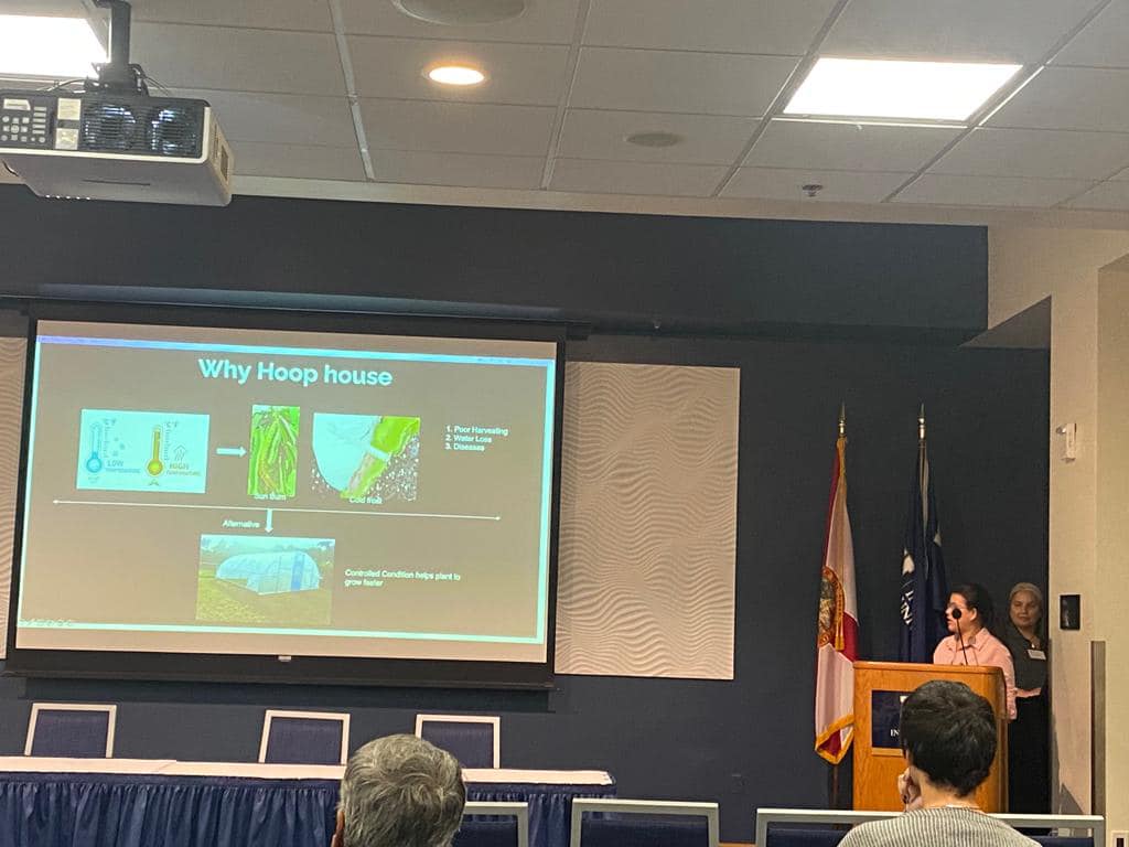
Objective
Assess high tunnel effects on dragon fruit physiology, nutrient concentrations, and spectral reflectance as a growth monitoring tool.
Methods
- RCBD: 3 species x 4 vermicompost treatments x 3 replicates; 72 total plants
- Soil + plant analysis via standard methods and XRF
- Spectral reflectance 350-2500 nm via spectroradiometer
Key Results
- High tunnel: higher K, Ca, Mg, Na, OM, CEC vs. open field
- Reduced nutrient leaching and runoff inside tunnels
- Spectral reflectance differentiated healthy from infected/sunburned plants
Conclusion
High tunnels provide an environmentally friendly approach for sustainable dragon fruit cultivation with enhanced soil conservation.
Image

Objective
Present findings on high tunnel cultivation enhancing soil fertility and nutrient retention for sustainable soil management.
Key Topics
- Soil fertility concepts and nutrient retention mechanisms
- Multi-year nutrient dynamics across 3 dragon fruit species
- Crop performance: height, stem thickness, chlorophyll indicators
- Sustainability outcomes and precision agriculture integration
Conclusion
High tunnels improve nutrient retention and soil health. Recommendations include organic inputs, farmer training, and sustainable policy promotion.
Image

Objective
Evaluate plant species suitability for green roofs in South Florida's subtropical climate.
Methods
- FIU Organic Garden setup mimicking rooftop design (4-6 inch depth)
- 8 species tested: Buckwheat, Cowpea, Bahiagrass, Millet varieties, Velvet Beans, Sun Hemp
- Growth monitored from 7 DAS through 84 DAS with soil sampling
Conclusion
Drought-resistant, heat-tolerant species combined with soil amendments provide best green roof strategy for urban sustainability.
Image

Objective
Analyze spectral changes from Botryosphaeria and Enterobacteria infections for early disease detection.
Key Results
- 22 plants partially affected; majority infected by Enterobacteria
- Infected plants showed lower NIR values and altered visible profiles
- High tunnel plants: higher K, Ca, Mg vs. open field
Conclusion
Spectral changes in diseased plants enable early detection, helping minimize yield loss via non-invasive monitoring.
Image
Objective
Identify dominant vegetation types and spectral signatures in Langtang watershed using Landsat-8 OLI imagery.
Key Results
- Dominant species: Rhododendron spp. and Larix himalica
- Band NIR best for species discrimination, independent of biophysical environments
- Reflectance similar in visible bands but markedly different in NIR
Conclusion
NIR band provides reliable spectral discrimination for vegetation mapping and biodiversity conservation in Nepal.
Image

Highlighted Publications
Five peer-reviewed journal papers, 10+ conference presentations, and 19 Google Scholar citations.
Selected Scholarly Work
Updated from the combined CV set and publication records, with the citation count highlighted for quick review.
Peer-Reviewed Papers
5
Journal papers from the CVs
Conference Presentations
10+
Research talks and proceedings
Google Scholar Citations
19
Current citation highlight
Linked Highlights
5
Selected records with links
Professional & Academic Projects
Expanded using the latest CV set and the project files stored in Downloads.
Description
Multi-year comparative research on dragon fruit production integrating hyperspectral imaging, Planet/NAIP satellite data, XRF/ICP-MS soil analysis, and disease detection via spectral reflectance. Primary dissertation research funded by USDA-NRCS.
Project Visuals
Description
Integrated soil chemistry, plant physiology, hyperspectral data, and geospatial analysis to support nutrient management, crop vigor assessment, and climate-resilient dragon fruit production.
Description
Led national-scale GIS support for land-use classification, zoning analysis, suitability modeling, hazard mapping, and multi-user geodatabase development for Nepal government planning workflows.
Project Visuals
Description
Municipal geodatabases integrating water, sewer, stormwater, roads, and parcels with subtypes, domains, and topology rules for infrastructure planning.
Project Visuals
Description
Multi-temporal Landsat/Sentinel classification for urban planning in Nepal — supervised classification and spectral indices for LULC mapping.
Project Visuals
Description
Hydrologic and terrain modeling using DEMs for flood-prone area maps, evacuation routes, and ArcGIS dashboards for disaster preparedness in Nepal.
Project Visuals
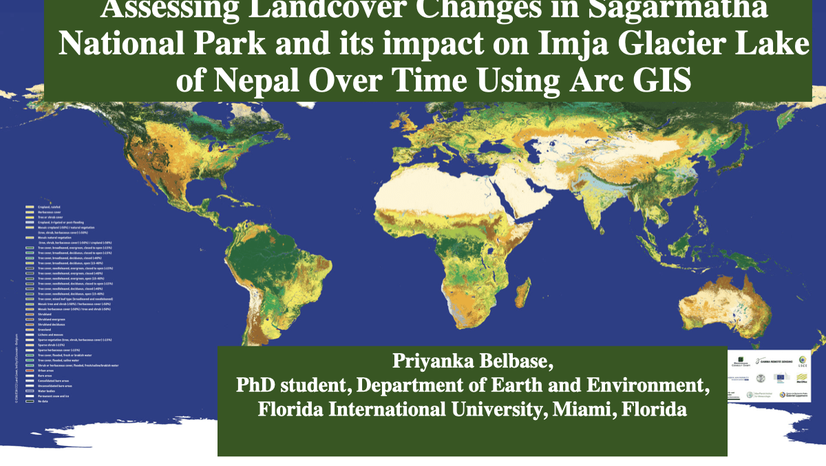
Description
Analyzed landcover transitions in Sagarmatha National Park and evaluated downstream implications for the Imja Glacier Lake system using ArcGIS-based change analysis.
Description
Explored elevation, aspect, and climate controls on treeline dynamics in the Nepal Himalayas to understand mountain ecosystem responses to environmental change.
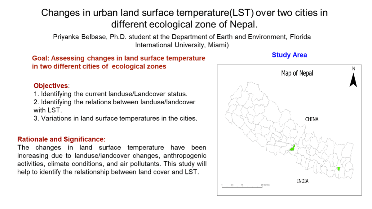
Description
Examined links between land surface temperature and land-use/land-cover change across two Nepali cities to quantify urban heat signatures and landscape drivers.
Description
Compared machine learning approaches for crop analysis and prediction workflows, focusing on model performance, feature behavior, and agricultural decision support.
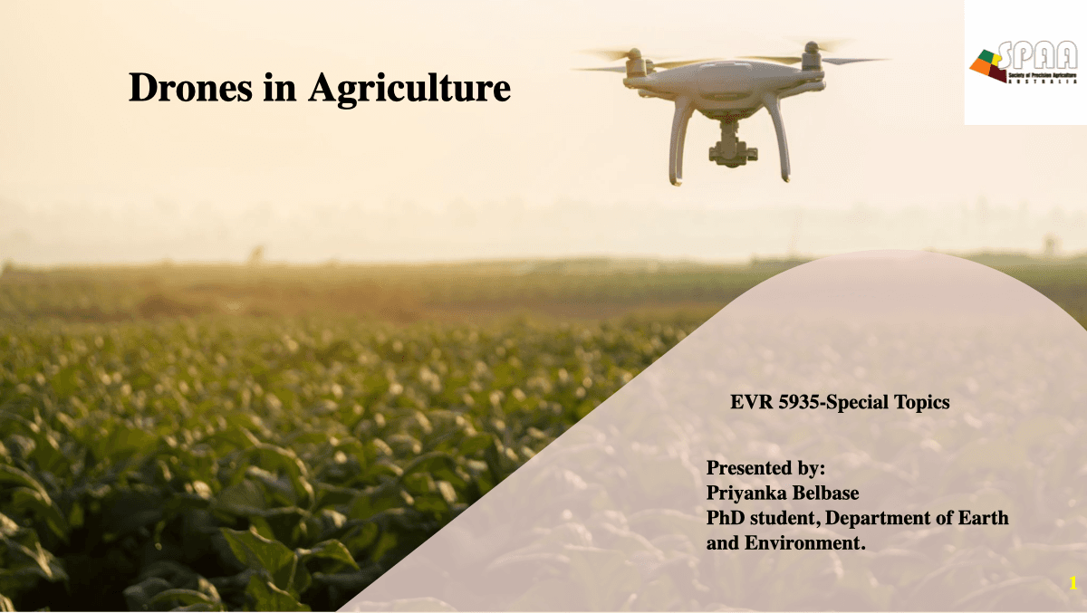
Description
Surveyed drone-enabled precision agriculture methods for crop scouting, herbicide targeting, and variable-rate management using high-resolution imagery.
Description
Assessed eutrophication indicators and lake condition patterns using remote sensing and GIS-derived water quality proxies for a major South Florida water body.
Description
Co-developed a literature-based graduate project examining black carbon behavior, Terra Preta soil properties, and the emerging impacts of microplastics on soil systems.
Description
Mapped tree canopy, impervious cover, and planting opportunity zones using LiDAR and NAIP imagery to support campus-scale cooling and green infrastructure planning.
Description
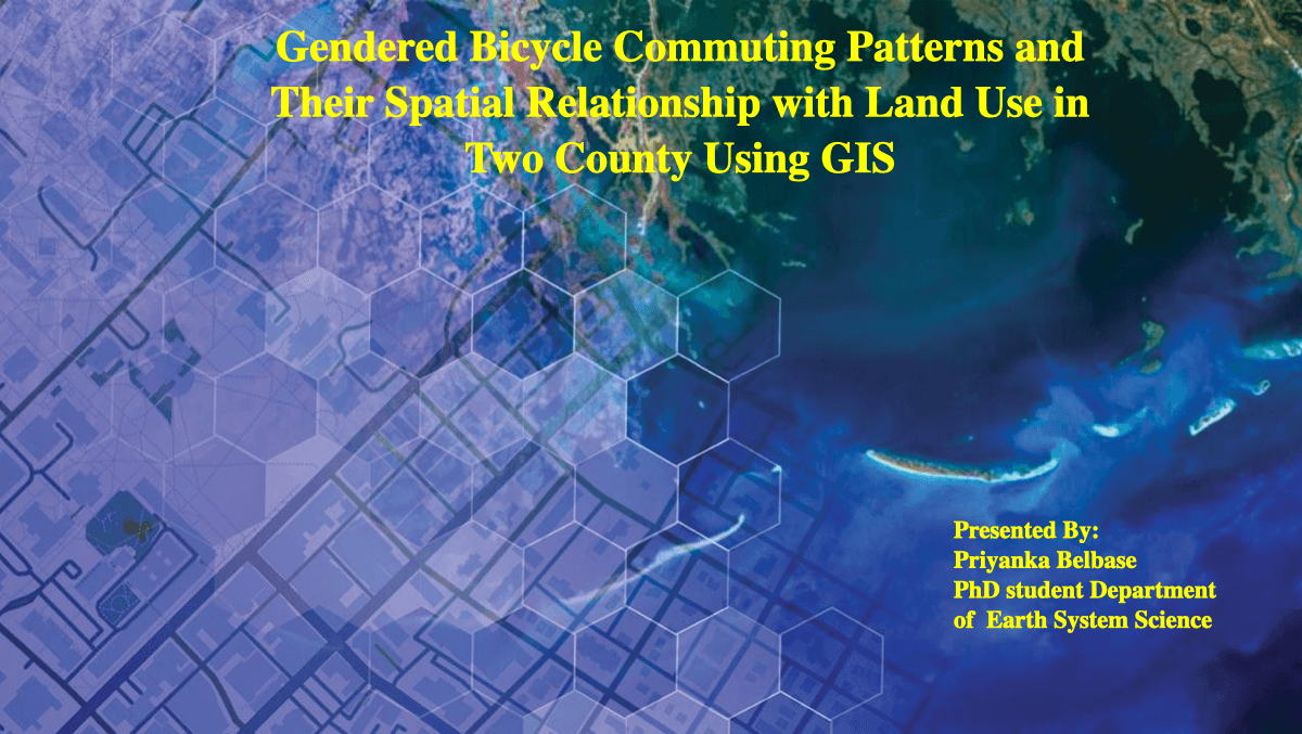
Investigated bicycle commuting patterns and their spatial relationship with land use across two counties, with emphasis on gendered accessibility and mobility outcomes.
Certifications
Continuous learning in GIS, remote sensing, machine learning, and data science.
Drone Analysis with Drone2Map and ArcGIS Online
LinkedIn • Aug 2025
QGIS and Python for AEC
LinkedIn • Apr 2025
AutoCAD Map 3D 2022 Essential Training
LinkedIn • Apr 2025
AutoCAD Map 3D Essential Training
LinkedIn • Mar 2025
AutoCAD 2022 Essential Training
LinkedIn • Apr 2025
AutoCAD MEP Essential Training
LinkedIn • Apr 2025
Community & Leadership
Community involvement carried over from the previous site version and expanded with CV-based leadership roles.
Women in GIS
Member
A global community empowering women in the geospatial industry through networking, mentorship, and professional development opportunities.
Visit OrganizationNepalese Student Association, FIU
Secretary · Jul 2024 – Jun 2025
Supported student programming, community coordination, and peer connection for the Nepalese student community at Florida International University.
Student organizationsWhy Community Matters
Advancing Geospatial Science
Contributing to GIS accessibility for environmental solutions.
Empowering Women in Tech
Supporting women representation in geospatial and STEM.
Knowledge Sharing
Mentoring in GIS workflows and remote sensing techniques.
Conferences & Field Work
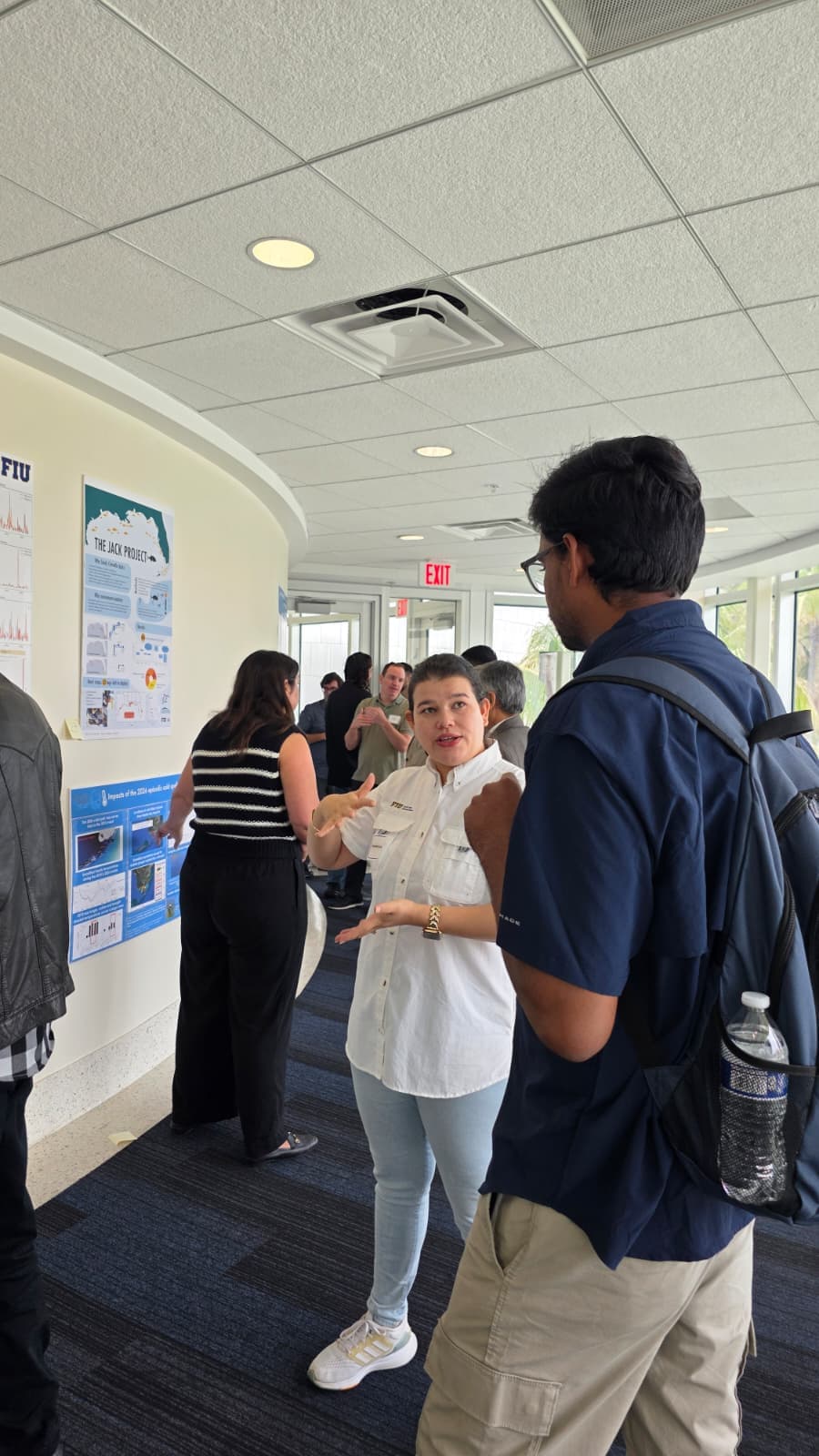
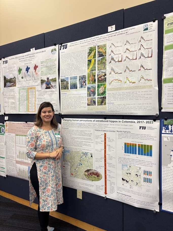
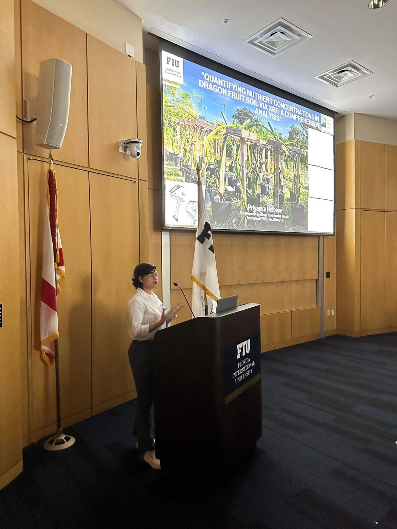
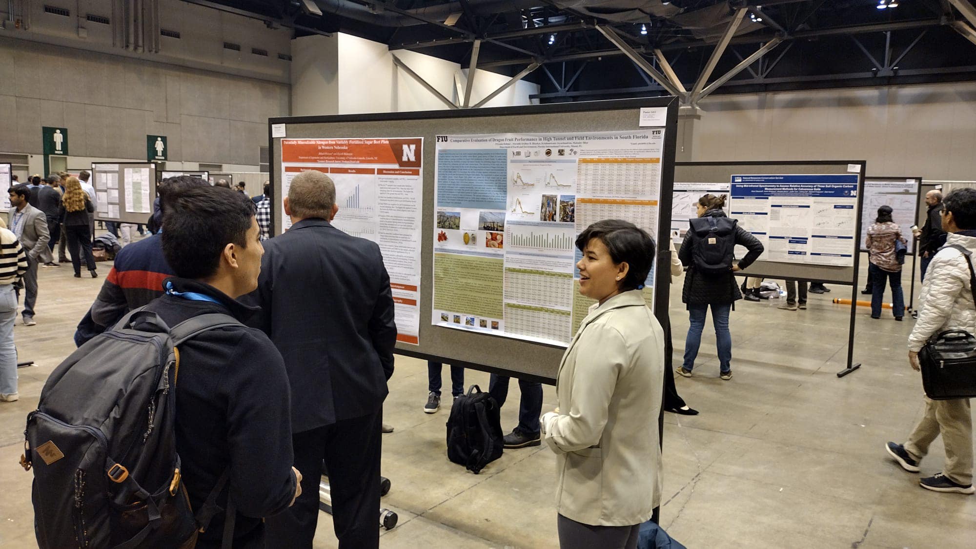
Poster Presentation at AGU 2024
AGU Fall Meeting 2024

Graduate Research Symposium 2023
Graduate Research Symposium 2024

GRS 2024 Poster

Graduate Research Symposium 2025

Graduate Research Symposium 2026
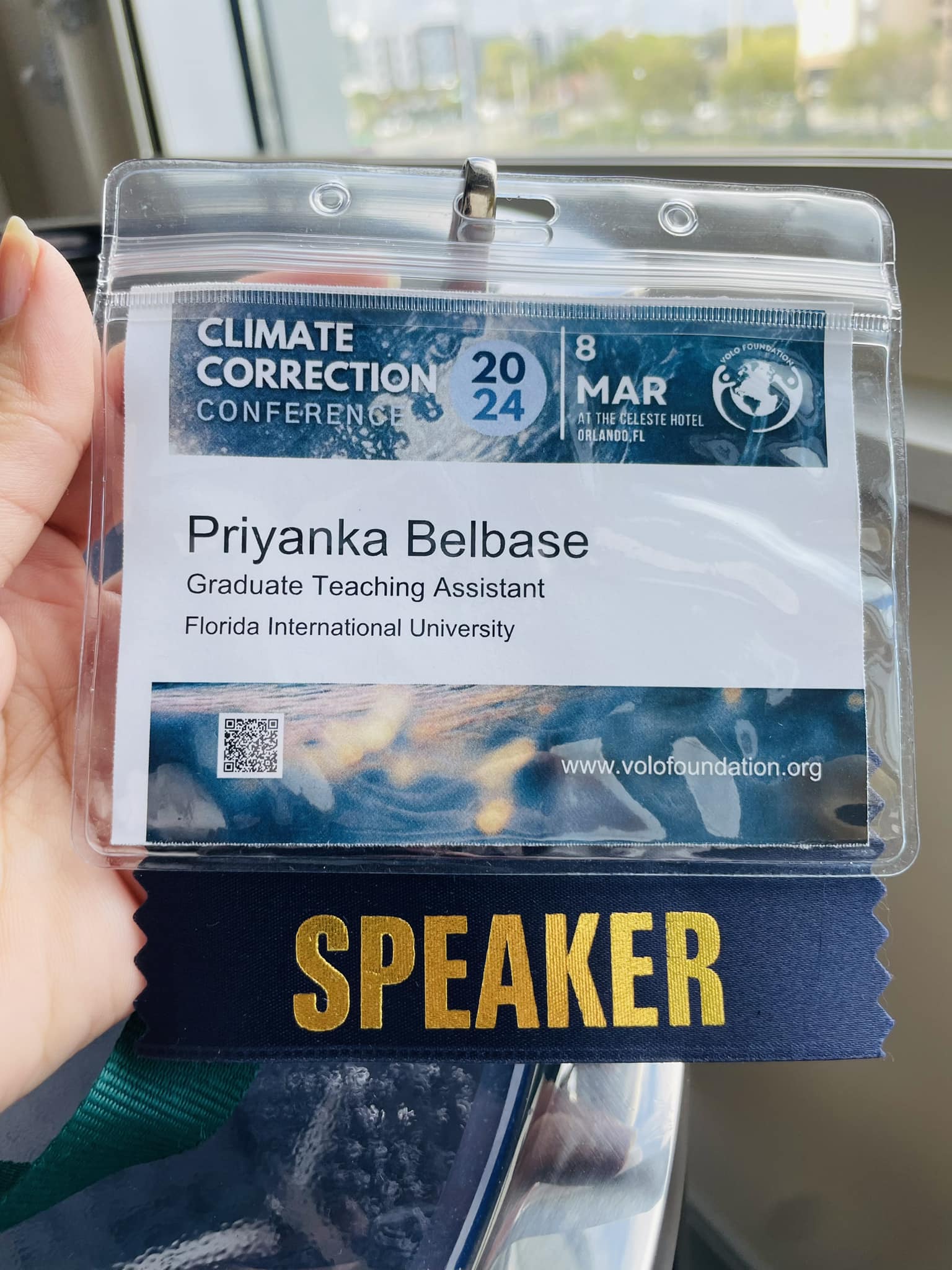
VoLo Climate Correction 2024
Climate Correction Conference
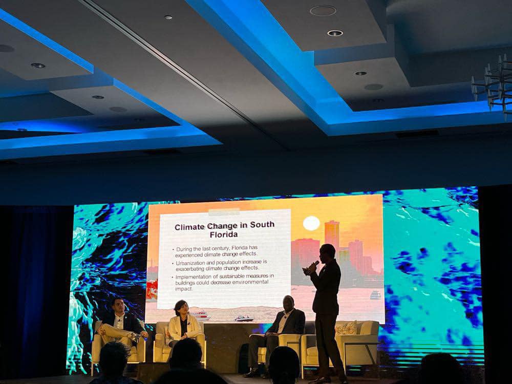
Speaker at VoLo Foundation
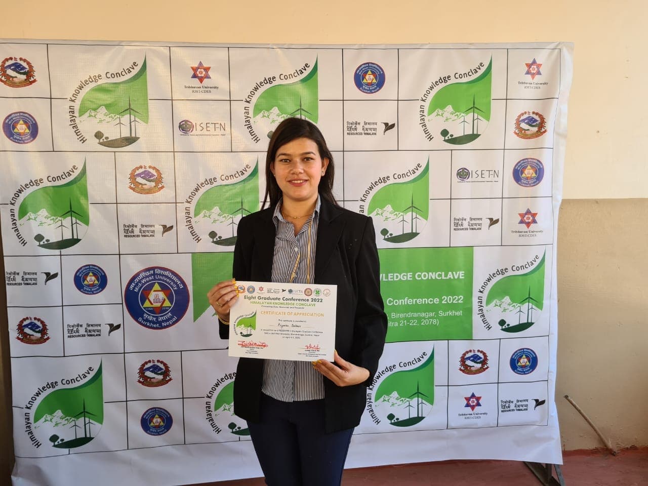
8th Graduate Conference, Nepal
Agroecology Symposium
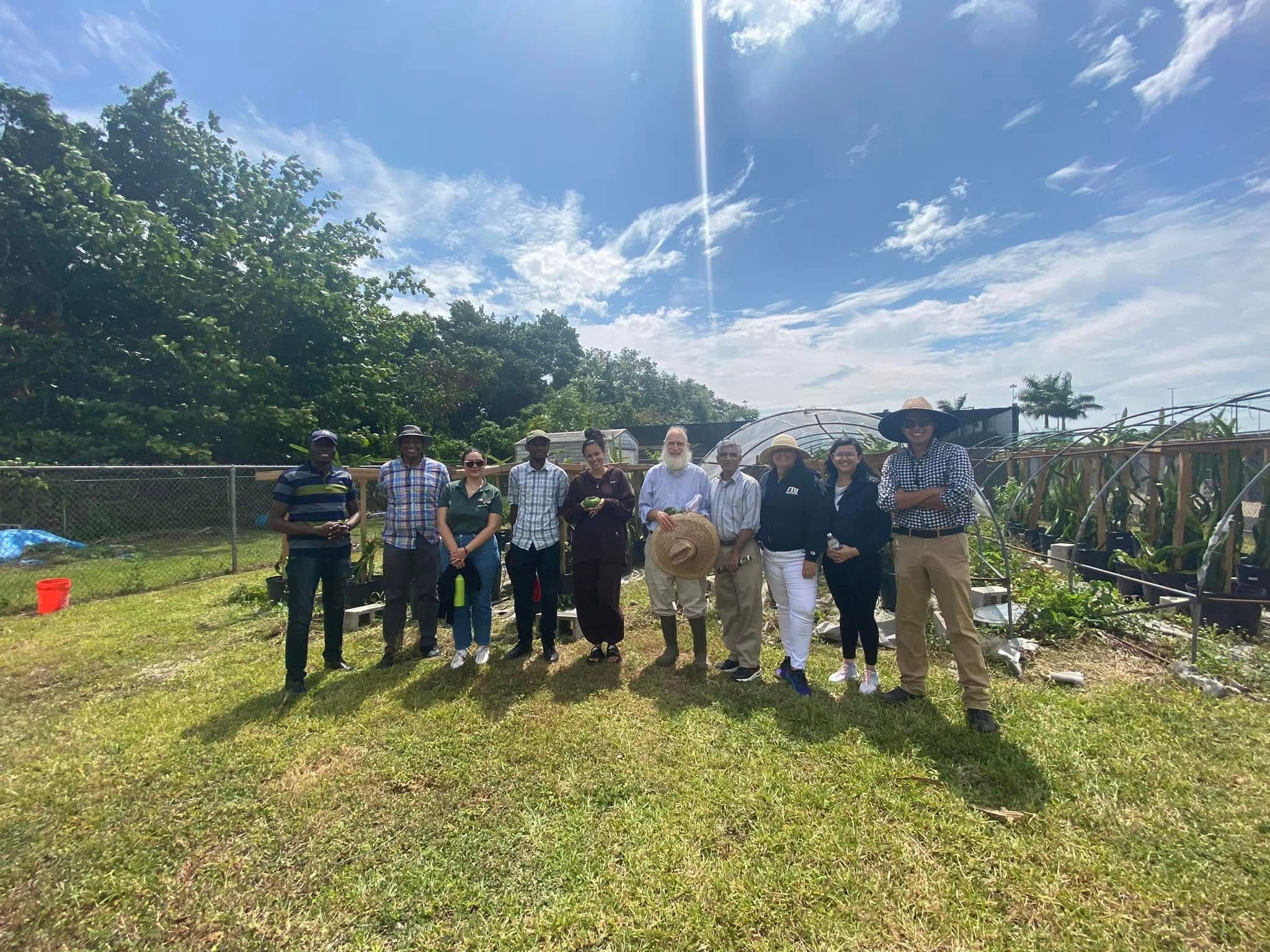
Agricultural Immersion Day
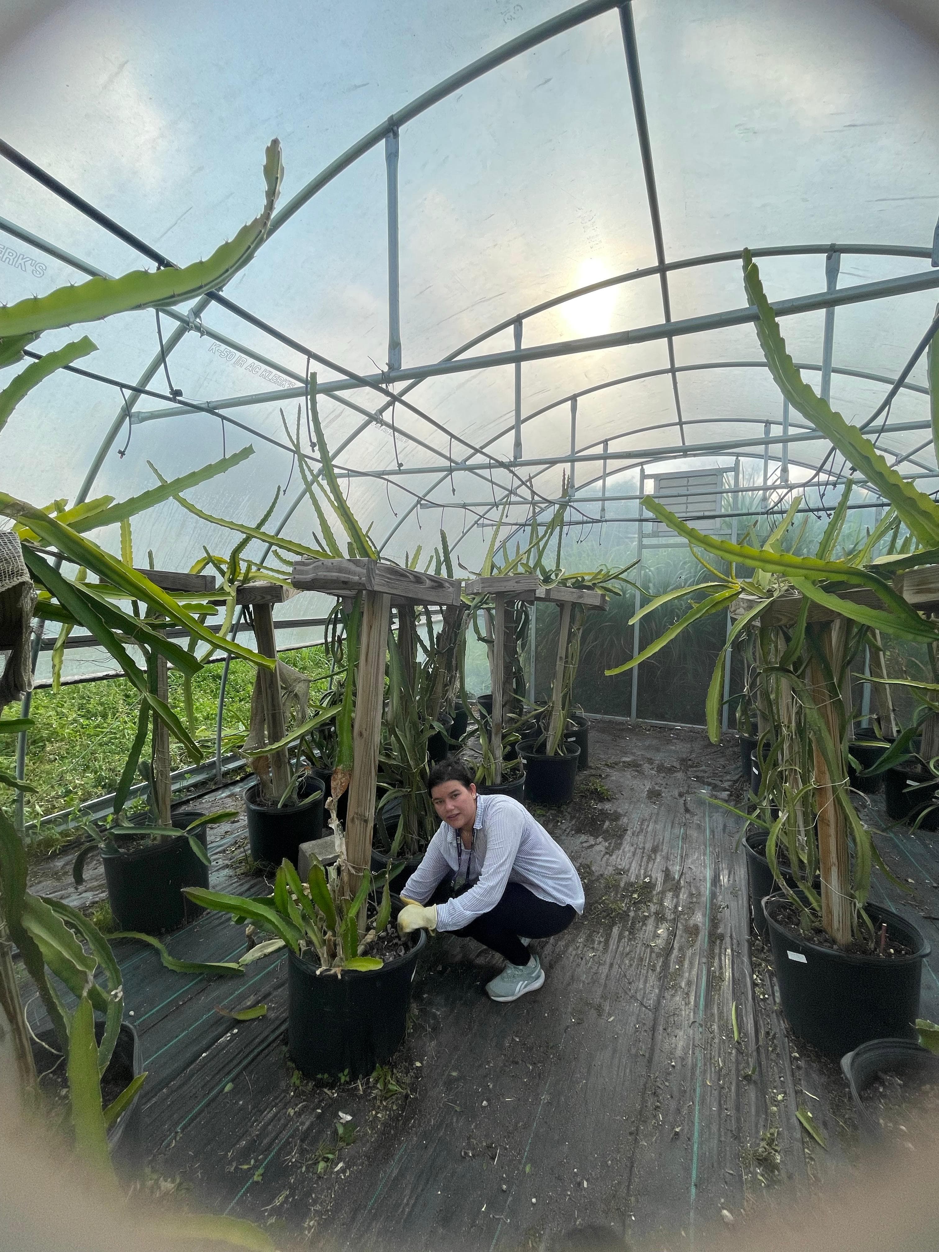
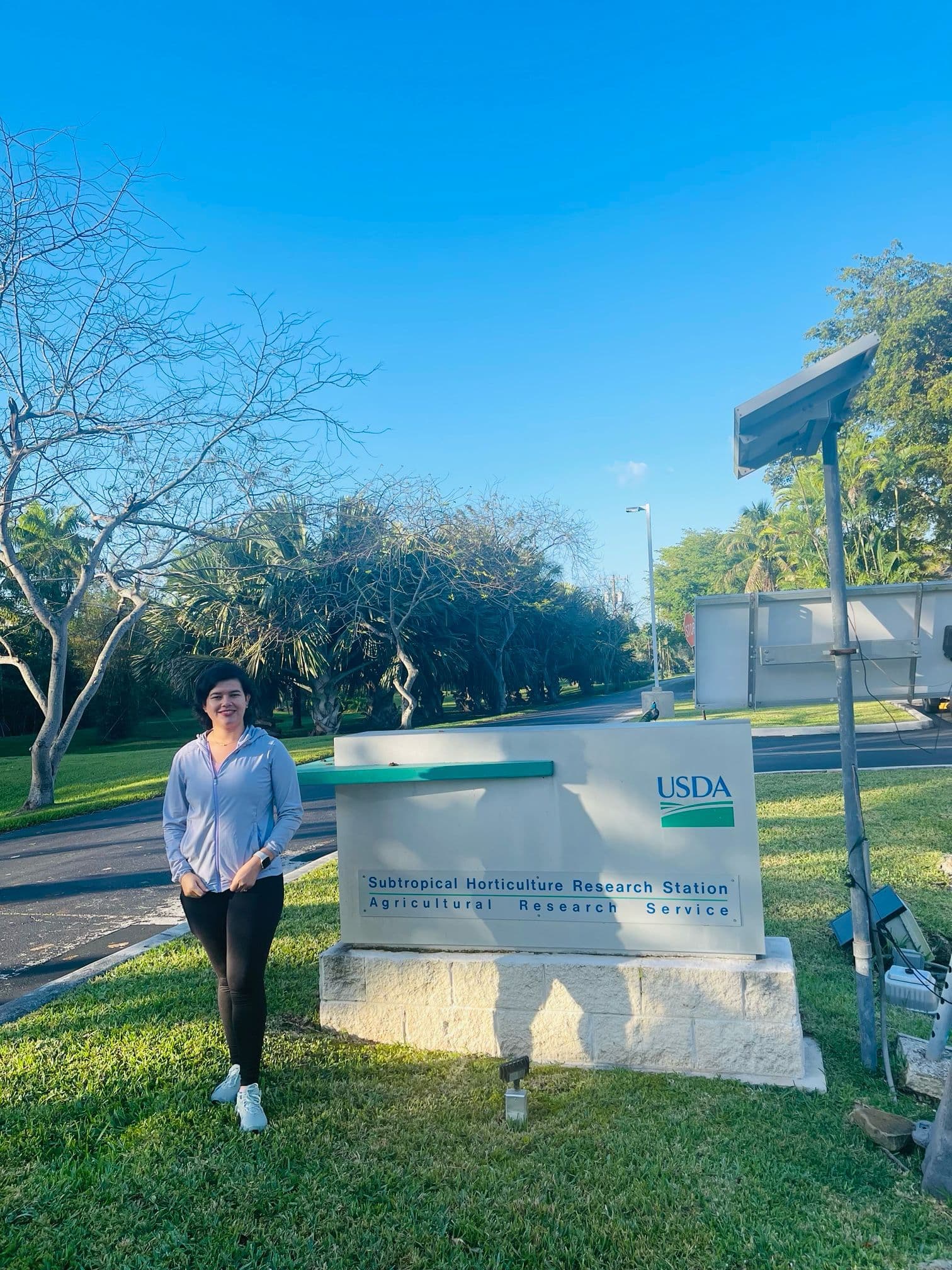
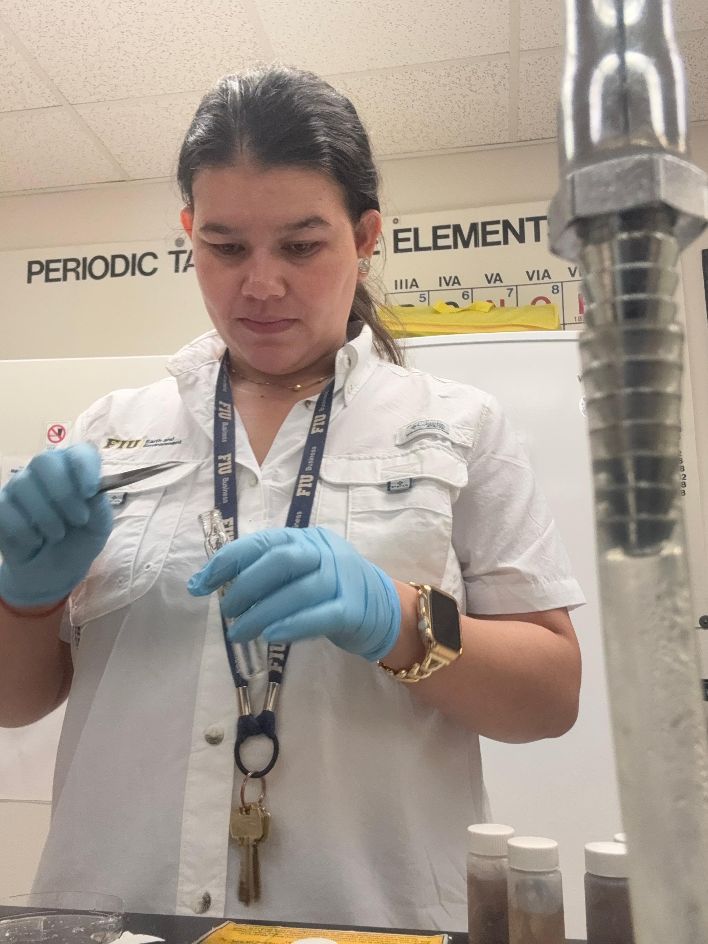
Research Team
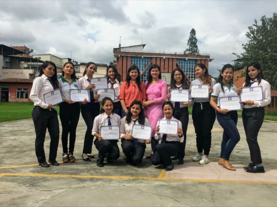
GIS Training
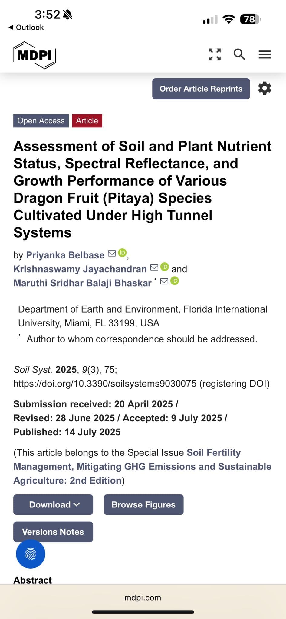
Journal Publication
Research Publication
Field Work 2026
Field Work 2026
.jpeg&w=3840&q=75)
Field Work 2026
.jpeg&w=3840&q=75)
Field Work 2026
Field Work 2026
.jpeg&w=3840&q=75)
Field Work 2026
Field Work 2026
.jpeg&w=3840&q=75)
Field Work 2026
Field Work 2026
.jpeg&w=3840&q=75)
Field Work 2026
Field Work 2026
Field Work 2026
Get In Touch
I'm always open to collaboration and new opportunities. Whether you need GIS analysis, remote sensing expertise, or want to discuss geospatial research, feel free to reach out.
Send Me A Message
© 2026 Priyanka Belbase. All rights reserved.
Built with passion for geospatial science 🌍